Idaho Hunt Planner We got game.
Unit 19
- Region 2
- Clearwater Region
- Selway Elk Zone
- Units 16A, 17, 19, 20
Game Management Unit Boundary
That portion of IDAHO COUNTY within the following boundary: beginning on the Salmon River at the mouth of Wind River, then up Wind River to Anchor Creek, then up Anchor Creek to Anchor Meadows, then northeast along the old wagon road (Forest Service Trail 313) to the divide between the Salmon River and South Fork Clearwater River, then east on the divide over Orogrande Summit and the Crooked River-Big Creek divide to Dixie Summit on the Red River Ranger Station-Dixie-Mackay Bar Road, then south on Red River Ranger Station-Dixie-Mackay Bar Road to Mackay Bar, then down the Salmon River to the mouth of Wind River, the point of beginning.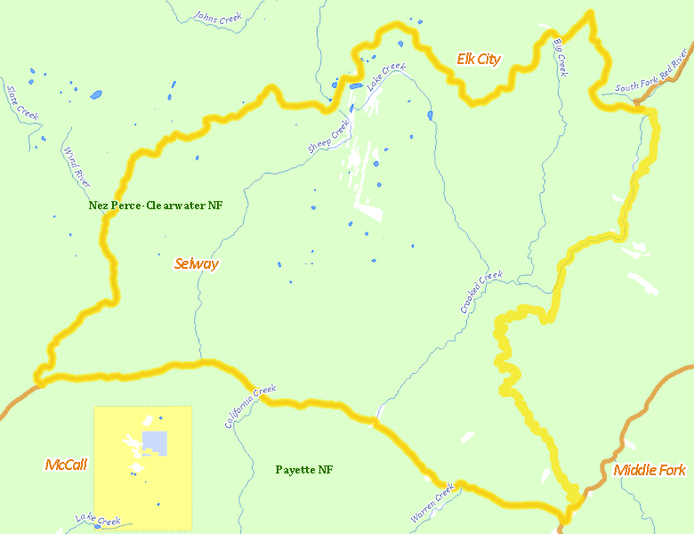
Public Access
Surface Management
For government land, these data show the managing agency of the land, which may or not be the same as the owning agency.
| U.S. Forest Service (USFS) |  98.44
%
98.44
%
|
| Private |
1.31
%
|
| Other |
0.26
%
|
Make your own map of Unit 19
Ownership data source: Inside Idaho
Access Yes! Properties
No properties are currently available in Unit 19.
View all Access Yes Participants.
National Forests
Federally-designated Wilderness Areas
No motorized vehicles are allowed in these areas.
-
Gospel Hump Wilderness
112,276 acres (67.94% of hunt area) -
Frank Church - River of No Return Wilderness
37 acres (0.02% of hunt area)
Land Use/Cover
| Forest |
100
%
|
Make your own map of Unit 19
Land Use data source: IDWR