Idaho Hunt Planner We got game.
Unit 13
- Region 2
- Clearwater Region
- Hells Canyon Elk Zone
- Units 11, 13, 18
Game Management Unit Boundary
That portion of IDAHO COUNTY bounded by the Snake River on the west, the Salmon River on the east and north and the White Bird-Pittsburg Landing Road on the south.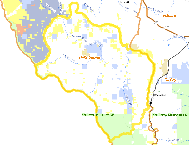
Public Access
Surface Management
For government land, these data show the managing agency of the land, which may or not be the same as the owning agency.
| Private |  71.53
%
71.53
%
|
| U.S. Bureau of Land Management (BLM) |
10.23
%
|
| U.S. Forest Service (USFS) |
8.83
%
|
| State of Idaho |
8.41
%
|
| Other |
0.69
%
|
Make your own map of Unit 13
Ownership data source: Inside Idaho
Access Yes! Properties
No properties are currently available in Unit 13.
View all Access Yes Participants.
National Forests
Federally-designated Wilderness Areas
No motorized vehicles are allowed in these areas.
There are no wilderness areas in Unit 13.
Land Use/Cover
| Forest |
53.4
%
|
| Rangeland |
46.53
%
|
| Urban |
0.02
%
|
| Irrigated-Sprinkler |
0.01
%
|
Make your own map of Unit 13
Land Use data source: IDWR