Idaho Hunt Planner We got game.
Hunt Area
Hunt Area 8-3X - Private land only (for the purpose of this hunt, private land does not include corporate timberlands). All of Unit 8 and that portion of Unit 8A south of the following line: Beginning at the junction of State Highway 9 and Old Avon Road, then east on Old Avon Road to Mica Mountain Road, then south on Mica Mountain Road to State Highway 9; AND that portion of Unit 8A south of the following line: Beginning at the western boundary of Unit 8A at State Highway 3 at Deary, then east on Highway 8 to Forest Service Road 1963 at Helmer, then south and east on Forest Service Road 1963 to Long Meadow Creek, then southeast along Long Meadow Creek to Dworshak Reservoir, then east along the shoreline of Dworshak Reservoir to the Unit 8A boundary at Dent Bridge.
More information about the Game Management Unit(s) in this area: 8 8A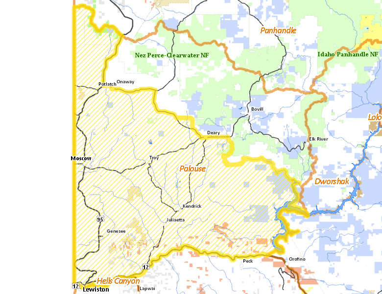
Surface Management
For government land, these data show the managing agency of the land, which may or not be the same as the owning agency.
 Private 92.2%
|
|
State of Idaho 3.94%
|
|
Indian Reservation / Bureau of Indian Affairs 2.18%
|
|
U.S. Forest Service (USFS) 0.64%
|
|
Other 0.57%
|
|
U.S. Corps of Engineers (COE) 0.34%
|
|
U.S. Bureau of Land Management (BLM) 0.11%
|
Make your own map of Hunt Area
Ownership data source: Inside Idaho
Access Yes! Properties
Access Yes! is Fish and Game program designed to improve hunting and fishing access to private land or through private land to public land by compensating willing landowners who provide access.
No properties are currently available in .
View all Access Yes Participants.
Forest Service Land
Check for road and area closures on National Forest websites
Federally-designated Wilderness Areas
No motorized vehicles are allowed in these areas.
There are no wilderness areas in .
Land Use/Land Cover
|
Dryland Agriculture
87.25
%
|
|
Forest
10.86
%
|
|
Water
1.29
%
|
|
Urban
0.58
%
|
|
Rangeland
0
%
|
Make your own map of Hunt Area
Land Use data source: IDWR