Idaho Hunt Planner We got game.
Hunt Area
That portion of Unit 32 west of the following boundary: beginning at the Unit 32/38 boundary in Emmett, then north on Highway 52 to the VanDussen Road, then north on the VanDussen Road to the Fourmile Road, then north on the Fourmile Road (which travels along Fourmile Creek) to the Riley Butte Road, then north on the Riley Butte Road to the North Crane Creek Road, then north on the North Crane Creek Road to the Indian Valley Road, then north on the Indian Valley Road to Highway 95.
More information about the Game Management Unit(s) in this area: 32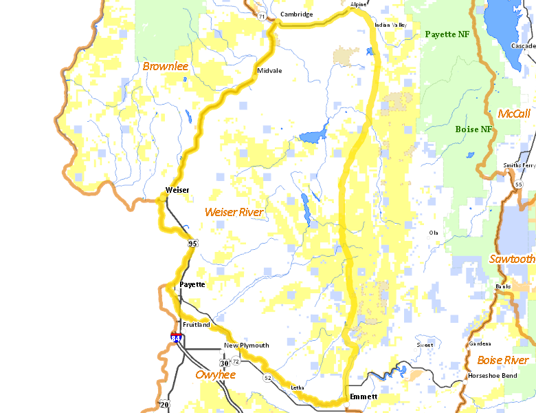
Recent Hunts in this Area
| Year | Tag | Open | Close | Take Method | Game | Area |
|---|---|---|---|---|---|---|
| 2024 | Elk Controlled Hunt 2157 | 11/16/2024 | 12/31/24 | Any Weapon | Elk | Area 32-1X |
Surface Management
For government land, these data show the managing agency of the land, which may or not be the same as the owning agency.
 Private 77.44%
|
|
U.S. Bureau of Land Management (BLM) 18.48%
|
|
State of Idaho 3.5%
|
|
Other 0.3%
|
|
State of Idaho 0.02%
|
|
U.S. National Wildlife Refuge (NWR) 0.02%
|
Make your own map of Hunt Area
Ownership data source: Inside Idaho
Access Yes! Properties
Access Yes! is Fish and Game program designed to improve hunting and fishing access to private land or through private land to public land by compensating willing landowners who provide access.
Forest Service Land
Check for road and area closures on National Forest websites
No National Forest lands fall within .
Federally-designated Wilderness Areas
No motorized vehicles are allowed in these areas.
There are no wilderness areas in .
Land Use/Land Cover
No landcover for this area is available at this time.