Idaho Hunt Planner We got game.
Hunt Area
That portion of Unit 30A north and west of the following boundary: Beginning at the junction of Highway 28 and McFarland Boulevard, then east on McFarland Boulevard to Eighteenmile Rd., then north on Eighteenmile Rd. to Bull Creek Rd., then east on Bull Creek Rd. to the junction with an unnamed road at the toe of the slope, then north on unnamed road to Hawley Creek Rd., then east on Hawley Creek Rd. to Rocky Canyon Rd., then north on Rocky Canyon Rd. to Highway 29, then west on Highway 29 to Highway 28, then south on Highway 28 to the point of beginning.
More information about the Game Management Unit(s) in this area: 30A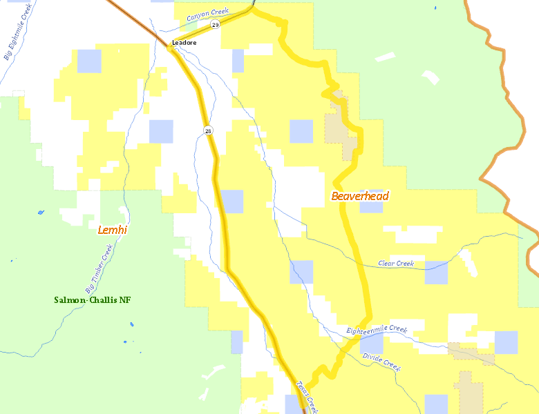
Surface Management
For government land, these data show the managing agency of the land, which may or not be the same as the owning agency.
 U.S. Bureau of Land Management (BLM) 69.95%
|
|
Private 25.4%
|
|
State of Idaho 4.64%
|
Make your own map of Hunt Area
Ownership data source: Inside Idaho
Access Yes! Properties
Access Yes! is Fish and Game program designed to improve hunting and fishing access to private land or through private land to public land by compensating willing landowners who provide access.
No properties are currently available in .
View all Access Yes Participants.
Forest Service Land
Check for road and area closures on National Forest websites
No National Forest lands fall within .
Federally-designated Wilderness Areas
No motorized vehicles are allowed in these areas.
There are no wilderness areas in .
Land Use/Land Cover
No landcover for this area is available at this time.
Towns in this Hunt Area
- Leadore, Idaho 28 Idaho 29