Idaho Hunt Planner We got game.
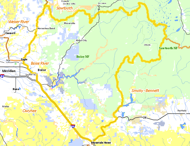
Boise River Zone
Unit 39
More information about GMU(s) in Boise River Zone :
Public Access
Land Ownership
| U.S. Forest Service (USFS) |  58.53
%
58.53
%
|
| Private |
23.22
%
|
| U.S. Bureau of Land Management (BLM) |
9.15
%
|
| State of Idaho |
5.71
%
|
| U.S. Bureau of Reclamation (BOR) |
1.58
%
|
| State of Idaho |
1.33
%
|
| Other |
0.28
%
|
| U.S. Military |
0.17
%
|
| U.S. Corps of Engineers (COE) |
0.01
%
|
| State of Idaho |
0.01
%
|
| Other |
0.01
%
|
Make your own map of Boise River Zone
Ownership data source: Inside Idaho
Access Yes! Properties
No properties are currently available in Boise River Zone.
View all Access Yes Participants.
National Forests
Federally-designated Wilderness Areas
-
Sawtooth Wilderness
89,011 acres (5.69% of hunt area)
Land Use/Cover
| Forest |
60.89
%
|
| Rangeland |
36.71
%
|
| Urban |
0.87
%
|
| Irrigated-Gravity Flow |
0.41
%
|
| Dryland Agriculture |
0.35
%
|
| Riparian |
0.27
%
|
| Irrigated-Sprinkler |
0.26
%
|
| Water |
0.23
%
|
Make your own map of Boise River Zone
Land Use data source: IDWR
Services
Lodging, Camping & Services in Boise River Zone
- Boise, Interstate 84 Idaho 55 Idaho 21
- Garden City, Idaho 55 Interstate 84
- Horseshoe Bend, Idaho 55 Idaho 52
- Idaho City, Idaho 21
- Atlanta, Idaho 21
* Services pages courtesy of the Official Idaho Travel and Tourism Guide