Idaho Hunt Planner We got game.
Tex Creek Zone
Units 66, 69
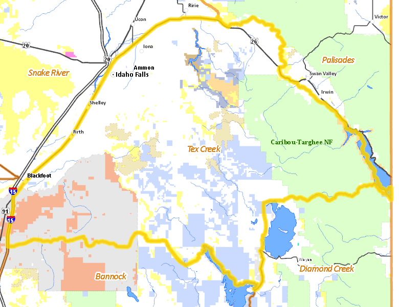
More information about GMU(s) in Tex Creek Zone :
Public Access
Land Ownership
| Private |  48.53
%
48.53
%
|
| U.S. Forest Service (USFS) |
17.83
%
|
| Indian Reservation / Bureau of Indian Affairs |
11.92
%
|
| State of Idaho |
11.54
%
|
| Indian Reservation / Bureau of Indian Affairs |
3.48
%
|
| U.S. Bureau of Land Management (BLM) |
3.32
%
|
| U.S. Bureau of Reclamation (BOR) |
1.67
%
|
| State of Idaho |
1.02
%
|
| U.S. Corps of Engineers (COE) |
0.53
%
|
| Other |
0.16
%
|
| U.S. National Wildlife Refuge (NWR) |
0
%
|
Make your own map of Tex Creek Zone
Ownership data source: Inside Idaho
Access Yes! Properties
No properties are currently available in Tex Creek Zone.
View all Access Yes Participants.
National Forests
Federally-designated Wilderness Areas
There are no wilderness areas in Tex Creek Zone.
Land Use/Cover
| Rangeland |
35.9
%
|
| Dryland Agriculture |
27.25
%
|
| Forest |
25.69
%
|
| Irrigated-Gravity Flow |
5.78
%
|
| Irrigated-Sprinkler |
3.61
%
|
| Water |
0.72
%
|
| Riparian |
0.64
%
|
| Urban |
0.41
%
|
Make your own map of Tex Creek Zone
Land Use data source: IDWR
Services
Lodging, Camping & Services in Tex Creek Zone
- Idaho Falls, Interstate 15 US 20 US 26
- Blackfoot, Interstate 15 US 26 US 91
- Shelley, US 91
* Services pages courtesy of the Official Idaho Travel and Tourism Guide