Idaho Hunt Planner We got game.
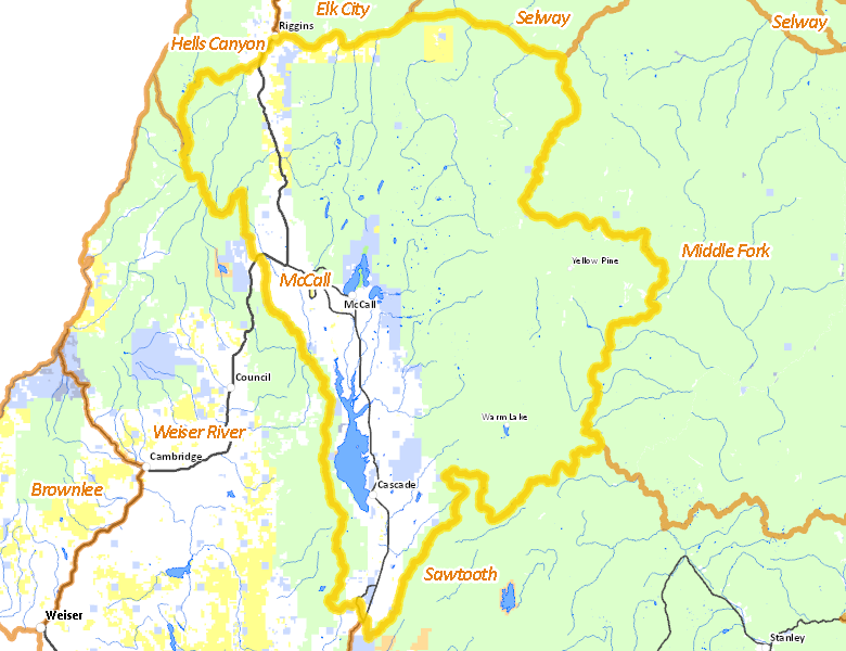
McCall Zone
Units 19A, 23, 24, 25
More information about GMU(s) in McCall Zone :
Public Access
Land Ownership
| U.S. Forest Service (USFS) |  73.58
%
73.58
%
|
| Private |
19.03
%
|
| State of Idaho |
4.03
%
|
| U.S. Bureau of Land Management (BLM) |
2.21
%
|
| Other |
0.6
%
|
| U.S. Bureau of Reclamation (BOR) |
0.42
%
|
| State of Idaho |
0.08
%
|
| State of Idaho |
0.05
%
|
Make your own map of McCall Zone
Ownership data source: Inside Idaho
Access Yes! Properties
No properties are currently available in McCall Zone.
View all Access Yes Participants.
National Forests
- Boise National Forest
- Nezperce National Forest
- Payette National Forest
- Salmon-Challis National Forest
Federally-designated Wilderness Areas
-
Frank Church - River of No Return Wilderness
54,739 acres (2.87% of hunt area) -
Hells Canyon Wilderness
11,669 acres (0.61% of hunt area)
Land Use/Cover
| Forest |
89.1
%
|
| Irrigated-Gravity Flow |
5.53
%
|
| Rangeland |
3.15
%
|
| Water |
1.02
%
|
| Riparian |
0.87
%
|
| Irrigated-Sprinkler |
0.31
%
|
| Urban |
0.03
%
|
Make your own map of McCall Zone
Land Use data source: IDWR
Services
Lodging, Camping & Services in McCall Zone
- McCall, Idaho 55
- Cascade, Idaho 55
- New Meadows, US 95 Idaho 55
- Riggins, US 95
- Yellow Pine, East Fork Rd.
- Warm Lake, Warm Lake Rd.
* Services pages courtesy of the Official Idaho Travel and Tourism Guide