Idaho Hunt Planner We got game.
Unit 37
- Region 7
- Salmon Region
- Lemhi Elk Zone
- Units 29, 37, 37A, 51
Game Management Unit Boundary
Those portions of CUSTER and LEMHI COUNTIES within the Salmon and Pahsimeroi River drainages east of the Salmon River, south and west of the Ellis-May-Howe Highway, and north and east of U.S. 93 between the U.S. 93 bridge across the Salmon River south of the town of Challis and Willow Creek Summit.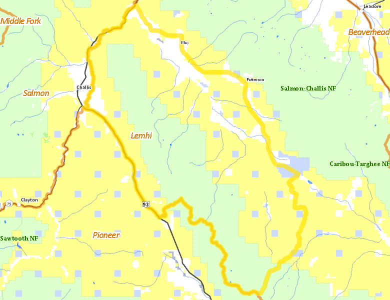
Public Access
Surface Management
For government land, these data show the managing agency of the land, which may or not be the same as the owning agency.
| U.S. Bureau of Land Management (BLM) |  49.33
%
49.33
%
|
| U.S. Forest Service (USFS) |
37.94
%
|
| Private |
9.57
%
|
| State of Idaho |
3.01
%
|
| Other |
0.1
%
|
| State of Idaho |
0.05
%
|
Make your own map of Unit 37
Ownership data source: Inside Idaho
Access Yes! Properties
No properties are currently available in Unit 37.
View all Access Yes Participants.
National Forests
Federally-designated Wilderness Areas
No motorized vehicles are allowed in these areas.
There are no wilderness areas in Unit 37.
Land Use/Cover
| Rangeland |
80.85
%
|
| Irrigated-Sprinkler |
8.84
%
|
| Forest |
7.69
%
|
| Irrigated-Gravity Flow |
1.91
%
|
| Dryland Agriculture |
0.52
%
|
| Riparian |
0.19
%
|
Make your own map of Unit 37
Land Use data source: IDWR