Idaho Hunt Planner We got game.
Hunt Area
All of Units 33 and 35, and that portion of Unit 34 south and west of the Landmark-Stanley Road.
More information about the Game Management Unit(s) in this area: 33 34 35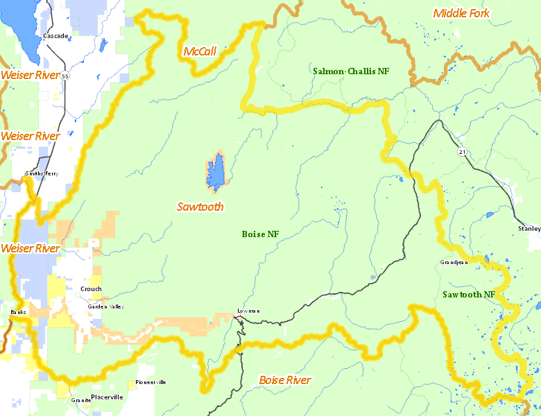
Recent Hunts in this Area
| Year | Tag | Open | Close | Take Method | Game | Area |
|---|---|---|---|---|---|---|
| 2024 | Deer Controlled Hunt 1090 | 11/10/2024 | 11/30/24 | Muzzleloader | Mule and White-tailed Deer | Area 33-1 |
| 2024 | Deer Controlled Hunt 1158 | 11/10/2024 | 11/30/24 | Muzzleloader | Mule and White-tailed Deer | Area 33-1 |
| 2024 | Elk Controlled Hunt 2125 | 11/10/2024 | 11/30/24 | Muzzleloader | Elk | Area 33-2 |
Surface Management
For government land, these data show the managing agency of the land, which may or not be the same as the owning agency.
 U.S. Forest Service (USFS) 88.28%
|
|
U.S. Bureau of Reclamation (BOR) 3.69%
|
|
Private 3.41%
|
|
State of Idaho 3.08%
|
|
U.S. Bureau of Land Management (BLM) 1.27%
|
|
Other 0.25%
|
|
State of Idaho 0.03%
|
Make your own map of Hunt Area
Ownership data source: Inside Idaho
Access Yes! Properties
Access Yes! is Fish and Game program designed to improve hunting and fishing access to private land or through private land to public land by compensating willing landowners who provide access.
No properties are currently available in .
View all Access Yes Participants.
Forest Service Land
Check for road and area closures on National Forest websites
Federally-designated Wilderness Areas
No motorized vehicles are allowed in these areas.
- Sawtooth Wilderness 61,099 acres (7.32% of hunt area)
Land Use/Land Cover
|
Forest
95.3
%
|
|
Rangeland
3.33
%
|
|
Irrigated-Gravity Flow
0.89
%
|
|
Water
0.34
%
|
|
Urban
0.09
%
|
|
Irrigated-Sprinkler
0.06
%
|
Make your own map of Hunt Area
Land Use data source: IDWR
Towns in this Hunt Area
- Garden Valley, Garden Valley Rd.
- Lowman, Idaho 21