Idaho Hunt Planner We got game.
Hunt Area
That portion of Unit 48 south of the Ketchum-Warm Springs Creek-Dollarhide Summit Rd. That portion of Units 43 and 44 west of the Pine-Featherville Road (FS Rd 61) and Rocky Bar Road 9FS Rd 156).
More information about the Game Management Unit(s) in this area: 43 44 48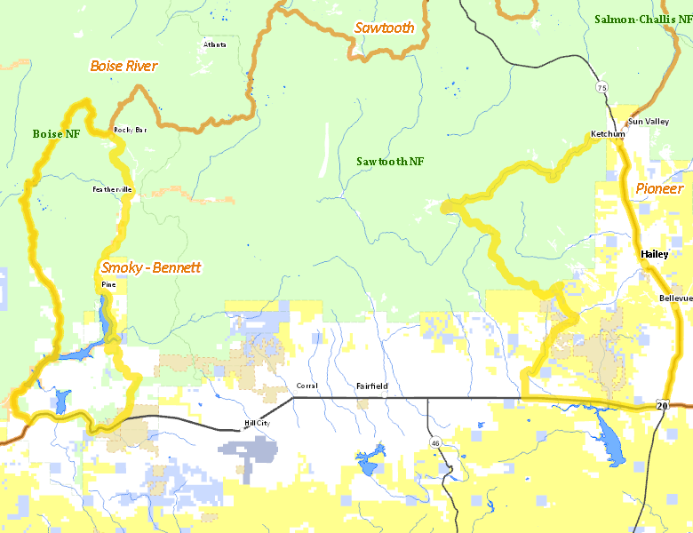
Surface Management
For government land, these data show the managing agency of the land, which may or not be the same as the owning agency.
 U.S. Forest Service (USFS) 50.75%
|
|
Private 30.26%
|
|
U.S. Bureau of Land Management (BLM) 14.81%
|
|
State of Idaho 2.85%
|
|
U.S. Bureau of Reclamation (BOR) 1.04%
|
|
Other 0.28%
|
|
State of Idaho 0.01%
|
Make your own map of Hunt Area
Ownership data source: Inside Idaho
Access Yes! Properties
Access Yes! is Fish and Game program designed to improve hunting and fishing access to private land or through private land to public land by compensating willing landowners who provide access.
Forest Service Land
Check for road and area closures on National Forest websites
Federally-designated Wilderness Areas
No motorized vehicles are allowed in these areas.
There are no wilderness areas in .
Land Use/Land Cover
No landcover for this area is available at this time.
Towns in this Hunt Area
- Hailey, Idaho 75
- Sun Valley / Ketchum, Idaho 75
- Bellevue, Idaho 75