Idaho Hunt Planner We got game.
Hunt Area
Private and state lands within the portion of Unit 1 beginning at the junction of Highway 95 and Highway 200, north on Highway 95 to the point where it crosses the Pack River, thence downstream/southeasterly on the Pack River to the point or intersection with Highway 200, then westerly on Highway 200 to the point of beginning, AND within the Sand, Grouse, Gold, Rapid Lightning and Trout Creek drainages, which flow into the Pack River.
More information about the Game Management Unit(s) in this area: 1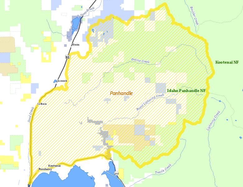
Surface Management
For government land, these data show the managing agency of the land, which may or not be the same as the owning agency.
 Private 57.71%
|
|
U.S. Forest Service (USFS) 35.84%
|
|
State of Idaho 5.19%
|
|
State of Idaho 0.89%
|
|
U.S. Bureau of Land Management (BLM) 0.37%
|
Make your own map of Hunt Area
Ownership data source: Inside Idaho
Access Yes! Properties
Access Yes! is Fish and Game program designed to improve hunting and fishing access to private land or through private land to public land by compensating willing landowners who provide access.
No properties are currently available in .
View all Access Yes Participants.
Forest Service Land
Check for road and area closures on National Forest websites
Federally-designated Wilderness Areas
No motorized vehicles are allowed in these areas.
There are no wilderness areas in .
Land Use/Land Cover
|
Forest
69.9
%
|
|
Dryland Agriculture
29.88
%
|
|
Urban
0.22
%
|
Make your own map of Hunt Area
Land Use data source: IDWR
Towns in this Hunt Area
No services are available inside .
Services courtesy of the Official Idaho Travel and Tourism Guide