Idaho Hunt Planner We got game.
Hunt Area
That portion of Unit 11 within one mile of cultivated fields and north of the following boundary: beginning at the Nez Perce County/Lewis County line on U.S. Highway 95, then west and south on the Nez Perce County/Lewis County line to Soldiers Meadow Road, then west on Soldiers Meadow Road to Zaza Road, then north on Zaza Road to Waha Road, then north on Waha Road to Redbird Road, then west on Redbird Road to the boundary of the Redbird Segment of Craig Mountain WMA, then north and west along the Redbird Segment Boundary to the Snake River.
More information about the Game Management Unit(s) in this area: 11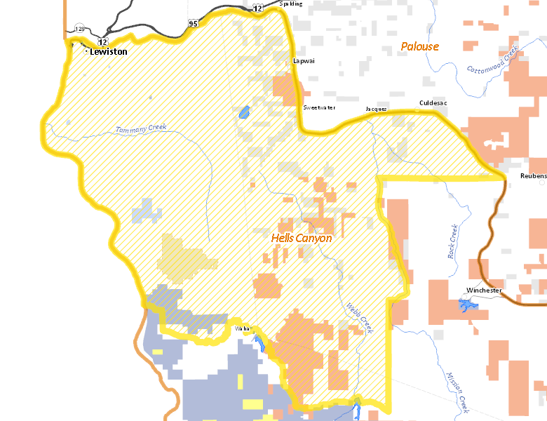
Recent Hunts in this Area
| Year | Tag | Open | Close | Take Method | Game | Area |
|---|---|---|---|---|---|---|
| 2024 | Deer Controlled Hunt 1123 | 10/10/2024 | 12/1/24 | Any Weapon | Mule and White-tailed Deer | Area 11-1X |
Surface Management
For government land, these data show the managing agency of the land, which may or not be the same as the owning agency.
 Private 82.64%
|
|
Indian Reservation / Bureau of Indian Affairs 7.85%
|
|
Indian Reservation / Bureau of Indian Affairs 6.35%
|
|
State of Idaho 1.82%
|
|
State of Idaho 0.52%
|
|
Other 0.07%
|
|
U.S. Bureau of Land Management (BLM) 0%
|
Make your own map of Hunt Area
Ownership data source: Inside Idaho
Access Yes! Properties
Access Yes! is Fish and Game program designed to improve hunting and fishing access to private land or through private land to public land by compensating willing landowners who provide access.
No properties are currently available in .
View all Access Yes Participants.
Forest Service Land
Check for road and area closures on National Forest websites
No National Forest lands fall within .
Federally-designated Wilderness Areas
No motorized vehicles are allowed in these areas.
There are no wilderness areas in .
Land Use/Land Cover
|
Dryland Agriculture
71.45
%
|
|
Forest
15.08
%
|
|
Rangeland
7.88
%
|
|
Urban
5.53
%
|
Make your own map of Hunt Area
Land Use data source: IDWR
Towns in this Hunt Area
- Lewiston, US 95 US 12