Idaho Hunt Planner We got game.
Hunt Area
All of Units 46 and 47 and that portion of Unit 41 east of the West Fork Bruneau River. *Deprecated in 2022, see AreaID 42*
More information about the Game Management Unit(s) in this area: 46 47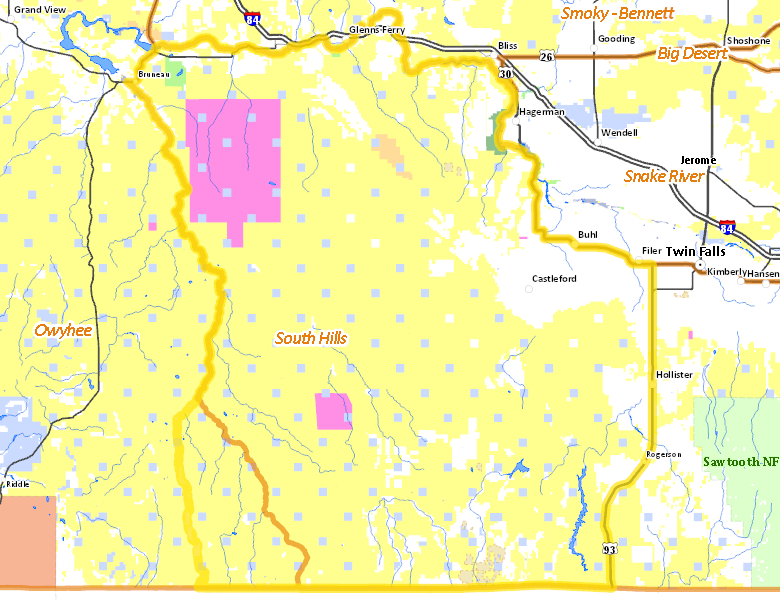
Surface Management
For government land, these data show the managing agency of the land, which may or not be the same as the owning agency.
 U.S. Bureau of Land Management (BLM) 71.33%
|
|
Private 17.93%
|
|
U.S. Military 5.59%
|
|
State of Idaho 4.13%
|
|
U.S. Bureau of Reclamation (BOR) 0.3%
|
|
State of Idaho 0.25%
|
|
Other 0.25%
|
|
U.S. National Park Service (NPS) 0.21%
|
|
State of Idaho 0%
|
Make your own map of Hunt Area
Ownership data source: Inside Idaho
Access Yes! Properties
Access Yes! is Fish and Game program designed to improve hunting and fishing access to private land or through private land to public land by compensating willing landowners who provide access.
Forest Service Land
Check for road and area closures on National Forest websites
No National Forest lands fall within .
Federally-designated Wilderness Areas
No motorized vehicles are allowed in these areas.
- Bruneau-Jarbridge Rivers Wilderness 63,228 acres (3.08% of hunt area)
Land Use/Land Cover
|
Rangeland
85.08
%
|
|
Irrigated-Gravity Flow
5.47
%
|
|
Irrigated-Sprinkler
5.15
%
|
|
Riparian
3.31
%
|
|
Urban
0.6
%
|
|
Rock
0.17
%
|
|
Water
0.11
%
|
|
Dryland Agriculture
0.1
%
|
Make your own map of Hunt Area
Land Use data source: IDWR