Idaho Hunt Planner We got game.
Hunt Area
[DEPRECATED] All of units 8, 8A, and 11 outside the National Forest System Boundary within 1 mile of private fields on which cultivated crops are currently growing. The National Forest System Boundary is a legislatively set boundary — it is not necessarily the boundary of Forest Service property. State, private and other lands within the National Forest System Boundary are not open to hunting during this season. (Please refer to a U.S. Forest Service map for the location of this boundary.) “Private fields on which cultivated crops are currently growing” is defined as: fields on which soil has been used or broken up for the raising of crops, and artificially irrigated pasture. “Currently” means during the current or most recent growing season. Lands enrolled in the Conservation Reserve Program (CRP) or other set-aside farm programs are specifically excluded.
More information about the Game Management Unit(s) in this area: 8 8A 11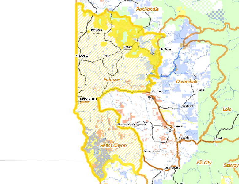
Surface Management
For government land, these data show the managing agency of the land, which may or not be the same as the owning agency.
 Private 79.47%
|
|
State of Idaho 6.3%
|
|
State of Idaho 5.11%
|
|
Indian Reservation / Bureau of Indian Affairs 3.86%
|
|
U.S. Bureau of Land Management (BLM) 2.44%
|
|
Indian Reservation / Bureau of Indian Affairs 1.3%
|
|
U.S. Forest Service (USFS) 0.43%
|
|
Other 0.36%
|
|
State of Idaho 0.24%
|
|
U.S. Corps of Engineers (COE) 0.23%
|
Make your own map of Hunt Area
Ownership data source: Inside Idaho
Access Yes! Properties
Access Yes! is Fish and Game program designed to improve hunting and fishing access to private land or through private land to public land by compensating willing landowners who provide access.
No properties are currently available in .
View all Access Yes Participants.
Forest Service Land
Check for road and area closures on National Forest websites
Federally-designated Wilderness Areas
No motorized vehicles are allowed in these areas.
There are no wilderness areas in .
Land Use/Land Cover
|
Dryland Agriculture
66.64
%
|
|
Forest
24.28
%
|
|
Rangeland
7.52
%
|
|
Urban
0.91
%
|
|
Water
0.63
%
|
Make your own map of Hunt Area
Land Use data source: IDWR
Towns in this Hunt Area
- Lewiston, US 95 US 12
- Moscow, US 95
- Cottonwood, US 95
- Craigmont / Winchester, US 95
- Troy, Idaho 8
- Potlatch, Idaho 6 US 95
- Deary, Idaho 8
- Elk River, Idaho 8